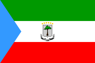
| EQUATORIAL GUINEA |  |
Introduction: Equatorial Guinea, officially the Republic of Equatorial Guinea is a country located in Middle Africa. With an area of 28,000 square kilometres it is one of the smallest countries in continental Africa. It is also the most prosperous; however, the wealth is concentrated in government and elite hands, with 70% of the population living under the United Nations Poverty Threshold of $2/day. It has a population of 650,702. It comprises two parts: a Continental Region (Río Muni), including several small offshore islands like Corisco, Elobey Grande and Elobey Chico; and an insular region containing Annobón island and Bioko island where the capital Malabo is situated.
Annobón is the southernmost island of Equatorial Guinea and is situated just south of the equator. Bioko island is the northernmost point of Equatorial Guinea. Between the two islands and to the east is the mainland region. Equatorial Guinea is bordered by Cameroon on the north, Gabon on the south and east, and the Gulf of Guinea on the west, where the island nation of São Tomé and Príncipe is located between Bioko and Annobón. Formerly the colony of Spanish Guinea, its post-independence name is suggestive of its location near both the equator and the Gulf of Guinea. It is one of the few territories in mainland Africa where Spanish is an official language, besides the Spanish cities of Ceuta and Melilla.
Equatorial Guinea is the third smallest country in continental Africa in terms of population. It is also the second smallest United Nations (UN) member from continental Africa. The discovery of sizeable petroleum reserves in recent years is altering the economic and political status of the country. Equatorial Guinea has been cited as an example of the natural resource curse; its gross domestic product (GDP) per capita ranks 28th in the world; however, most of the country's considerable oil wealth actually lies in the hands of only a few people.
Equatorial Guinea has one of the worst human rights records in the world, consistently ranking among the "worst of the worst" in Freedom House's annual survey of political and civil rights and Reporters Without Borders ranks President Obiang among its "predators" of press freedom.
Out of 44 sub-Saharan countries, Equatorial Guinea ranks 9th in terms of the Human Development Index (HDI) and 115th overall, which is among the “medium” HDI countries.


No comments:
Post a Comment